


Click on a photo to enlarge it.
We drove through heavy traffic to get back to the Jumbo supermarket and then headed out of the city, north along the Ruta 5. We stopped at a Copec petrol station where we paid 500 pesos each (about 80 cents) for very nice hot showers in a very clean and obviously new shower and toilet building.
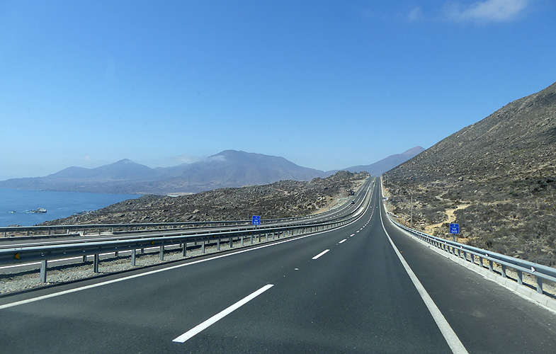
We continued north along a very nice tarmac highway along the coast and then up long switchbacks to over 1000m and into desert landscape. There was nothing around, not even anything growing, just miles of sand and hills. The road was in very good condition which we were very happy about but there were two tolls along the route. Understandable, it must have cost a fortune to build this road. Both tolls cost 2,500 pesos each ($3-60).
We suspect that this road was mainly built for all the trucks and lorries who transport goods north and south. The truck tolls are around 40,000 pesos, almost $60! No wonder everything is more expensive in the shops here.
We drove almost 190km and arrived in Vallenar at 6-45pm. We stayed at a Copec gas station which was surprisingly quiet for the night. The next morning I saw a small pick up truck with 20 litre bottles of purified water. I dashed out and the driver pulled up to Winnietwo. They have the same system as in Mexico - namely you need to exchange an empty bottle for a new one or buy the bottle which costs around $15. We don't have a bottle to exchange but I explained that we wanted to transfer the water into our own containers and there wasn't a problem.
We paid 2,000 pesos ($3) each for two 20 litre bottles which we transferred into one of our 40L containers. Obviously our containers are not as big as we thought, only around 33L. But at least we had other empty 6 litre bottles that we could transfer the water into. The driver even helped me transfer all the water. The Chileans are really very nice and helpful people.
Between Vallenar and Copiapó on Ruta 5 there was another toll station. This time we had to pay 3,950 pesos ($6-80). We turned off the highway and drove to Tierra Amarillo, a very dusty and hot town where we took a short break at a petrol station.
Our plan was to drive up to Paso San Francisco at 4,748m and on the border with Argentina. We wouldn't cross the border but turn around and take a different inland route further north instead of driving up and down the same way. It would be over 500km between petrol stations so we filled up to the three quarter mark as we still haven't got around to finishing the repairs to our diesel tank. There is just one small hole but we haven't found anywhere suitable that we can get underneath our vehicle to fix it. At least we will have enough to drive the distance.
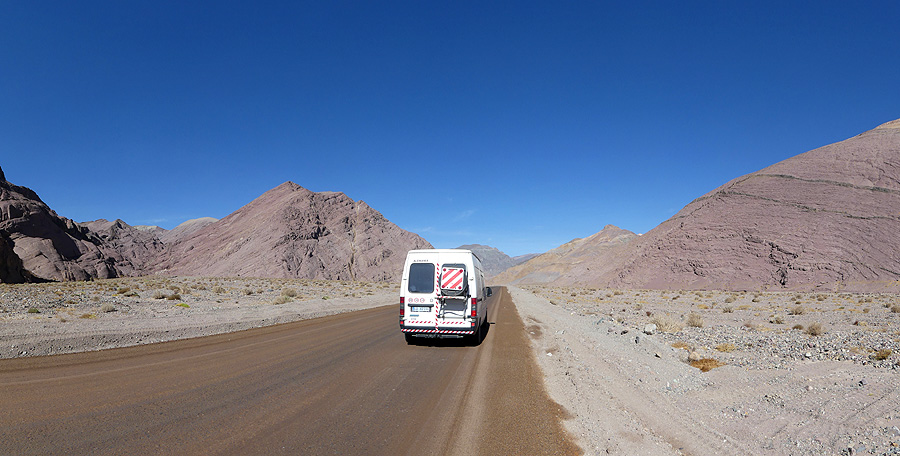
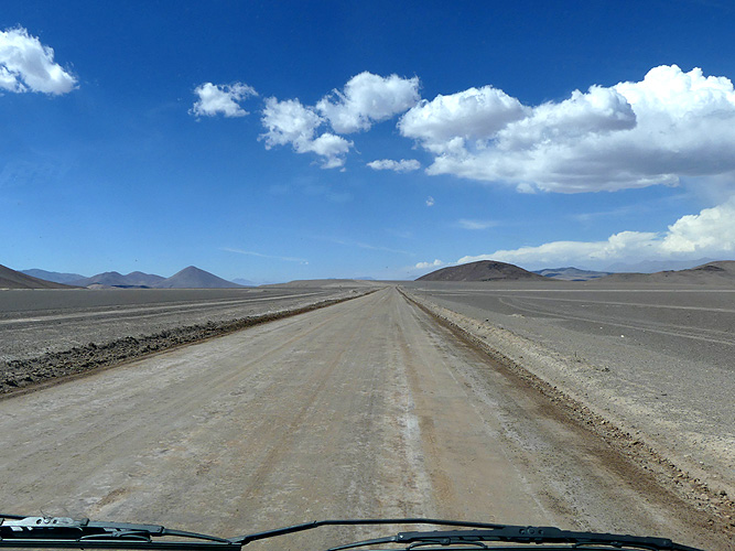
We had no idea of the state of the road up to the pass. In our new Copec books it is marked as green which is a hard surface but not tarmac. Our GPS route would take us further along a road marked as tarmac and then cut off right on a connecting road to meet up with the road marked as green.
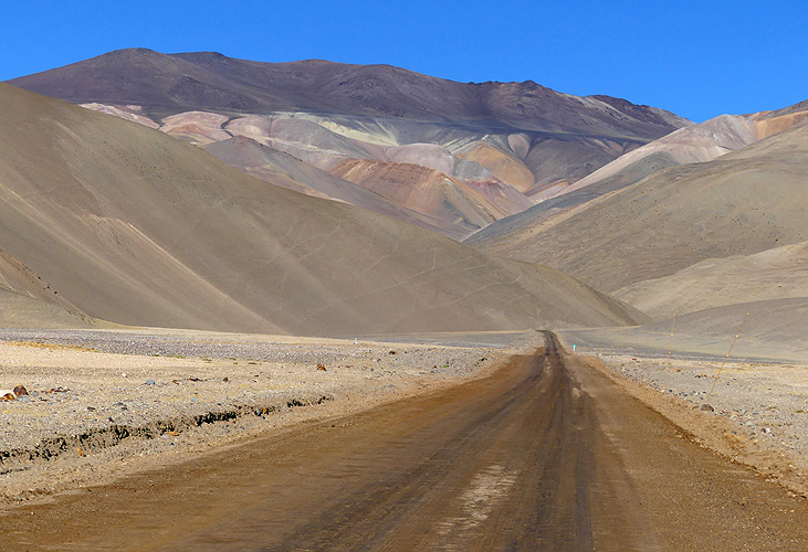
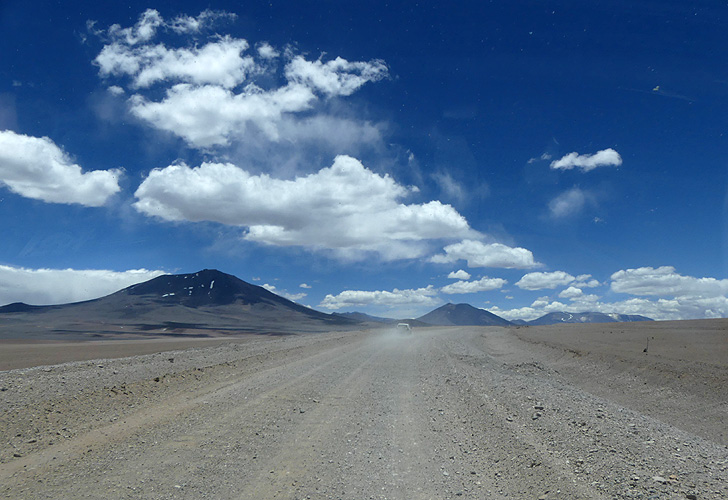
As we drove along the route we saw the signs for Paso San Francisco turning off to our right. As we drove past it looked like it was a good road. I turned around and decided we should try that route rather than the one we had programmed into our GPS. It was marked and signposted as the official route and I knew that there is a lot of traffic using this route between the two countries. So we took the route and hoped it was okay.
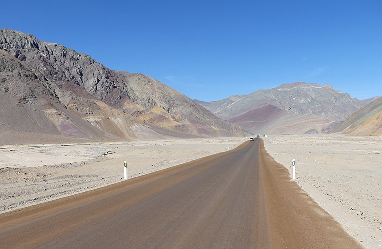
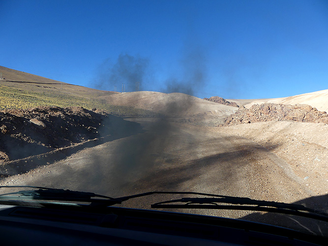
It was perfect! A hard packed surface sprayed with what we believe to be bitumen. Very smooth and easy to drive. There isn't even any dust that we'll need to clean up afterwards and I finally get to look at the scenery instead of having to watch out for the next hole, big stone or other obstacle lying ahead of us.
The road went gradually uphill but we only realised it by looking at our altitude on the GPS. We'd set off just under 500m and as we got past 2000m I pulled over into the shade for a few minutes. The engine had got a bit hot because the wind is behind us and not cooling the engine. I switched on the ventilator that Steffen, the previous owner, had built in and let the engine run in the shade to cool down.
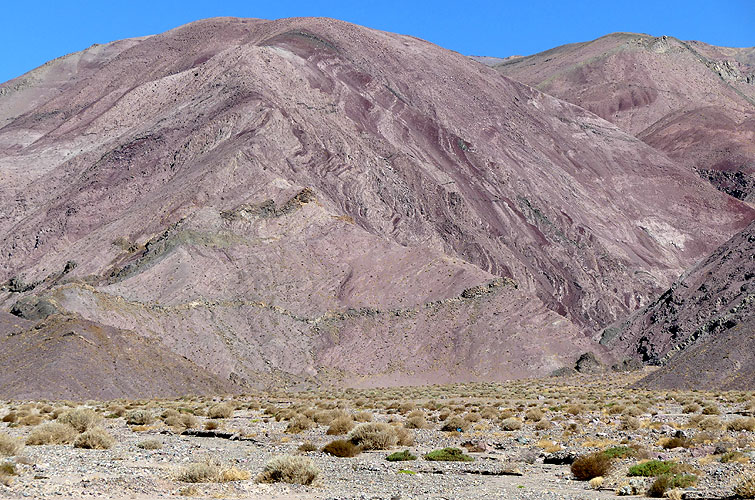
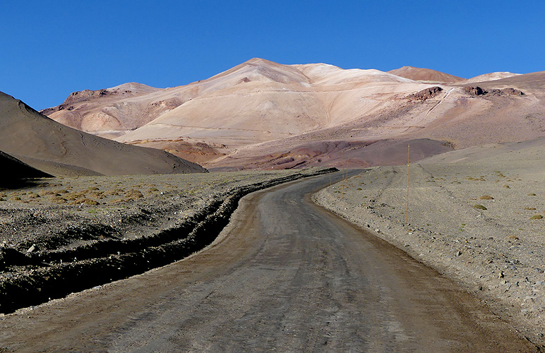
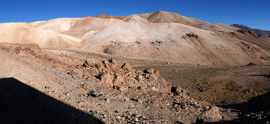
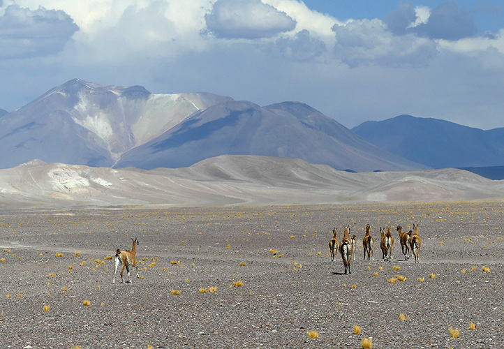
We set off again driving through painted hills and desert. Then we went through a lush valley at 2,500m. It was very green, there were a few shacks around and quite a few donkeys. It was like an oasis in the desert. Then it was back to desert again.
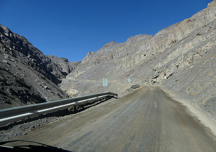
Eventually the good road turned into gravel and went up steep switchbacks over a pass at 4,600m and then descended into a valley where the customs office was situated. We got back onto tarmac again but it was already 8-30pm. The customs building had a barrier across the road and the office had already closed. There would have been a nicer overnight spot about 300metres further on next to a laguna but they wouldn't be opening the barrier for us to get through so we ended up spending the night on the car park.
It had been a wonderful drive up here and there were only a few cars on the road, mainly coming from the other direction. They were all Argentinians heading for a beach holiday in Chile. We hadn't expected to get this far today, believing that the road would slow us down and we'd have to find somewhere along the route. Now we'd made it up to the customs office and would be staying for the night at 3,800m. Not ideal as far as altitude is concerned, seeing as we'd come from only 500m above sea level. Oh well, too late now. Hopefully Kirsten will be able to cope.
We were very hungry so Kirsten made quesadillas for a quick meal whilst I did the usual dust cleaning. We didn't eat until 9-15pm - the time when most Argentinians eat their evening meal!
Neither of us slept very well. I had a blocked nose which didn't help me to breathe up at this height and Kirsten was getting a headache. She also felt sick so I got a bucket with plastic bags inside just in case. We don't think Kirsten was suffering from altitude sickness because she experienced that in Bolivia in 2002 and it was far, far worse. So it could have been the usual monthly migraine.
After I made her a cup of tea she felt a lot better so we decided to try and get up to Laguna Verde (4325m) which was about 20km before the actual pass up at 4748m. It was noon before we left and because we were staying in Chile we didn't need to go through the border formalities. We were allowed to drive past the side of the customs building and Kirsten got out to unhook the chain so I could drive through. We were told to take the same route when we returned. Great! No paperwork and no food controls.
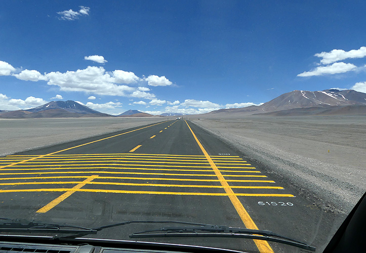
The road was very good tarmac for 60km through the high desert and past many painted hills and volcanoes. It also went through part of the Nevado de Tres Cruces National Park. Sadly the tarmac came to an end and the road turned into very bad gravel. It was another 27km to Laguna Verde and 41km to the pass. It took us over 20 minutes to drive the first 6km and we knew it would take us well over 3 hours just to get up to the laguna and back to the customs building.
We were already up to 4,600m and would be spending hours up at this altitude. The road was just too bad so we turned around. It wasn't worth it. There are plenty of other Laguna Verdes on this continent and we might drive up to the pass from the Argentinian side which is all tarmac. It had been a spectacular drive and we didn't need to push our luck so we headed back.
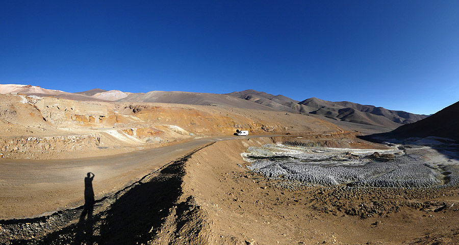
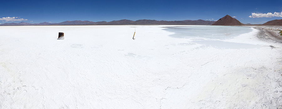
Before we got back to the customs building we pulled off to the left and parked at Salar de Maricunga the southern most salt lake in Chile. The lake shimmered blue in the sunlight and we had a late lunch break.
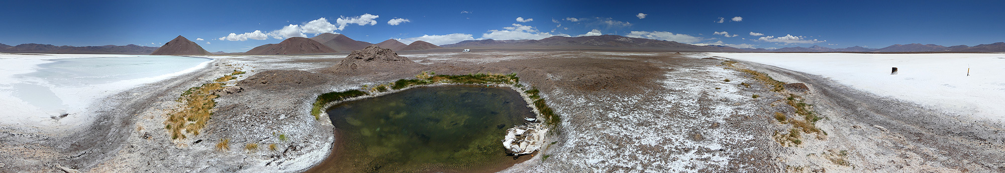 Salar de Maricunga - 360° Panorama
(move mouse over panorama and click on the arrows)
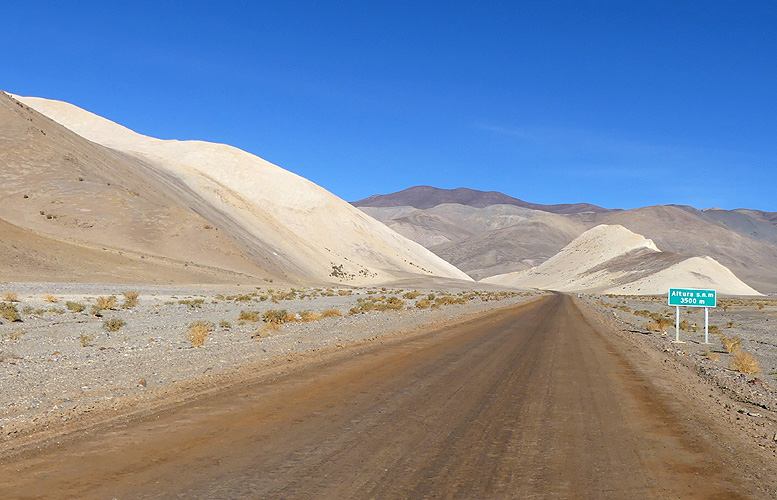
Just after 4pm we drove back past the side of the customs building, going through the chain barrier again, and past a queue of vehicles waiting in line to get through customs. They probably wondered what on earth we were doing! Then we took a different route back - the C173. It took us across a high plateau, north to Salar de Pedermales which is 30,000 hectares and at 3,350m.
This road was also a very good hard packed road and easy to drive with even less traffic. The scenery was the same high desert and clouds were building up over the mountains but heading across the mountain range and not coming towards us.
The road turned and headed south then we came to a fork where there were two routes to take to our destination El Salvador. One went steeply uphill to our right and the other was the main signposted road. So we took the latter.
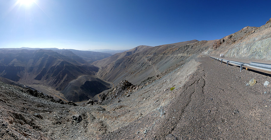
We'd only driven about 15km when we came to a large bend and a great view of a deep canyon below us. The road went down long switchbacks into the canyon over 1000m below. It was a great drive down and then we went through a valley.
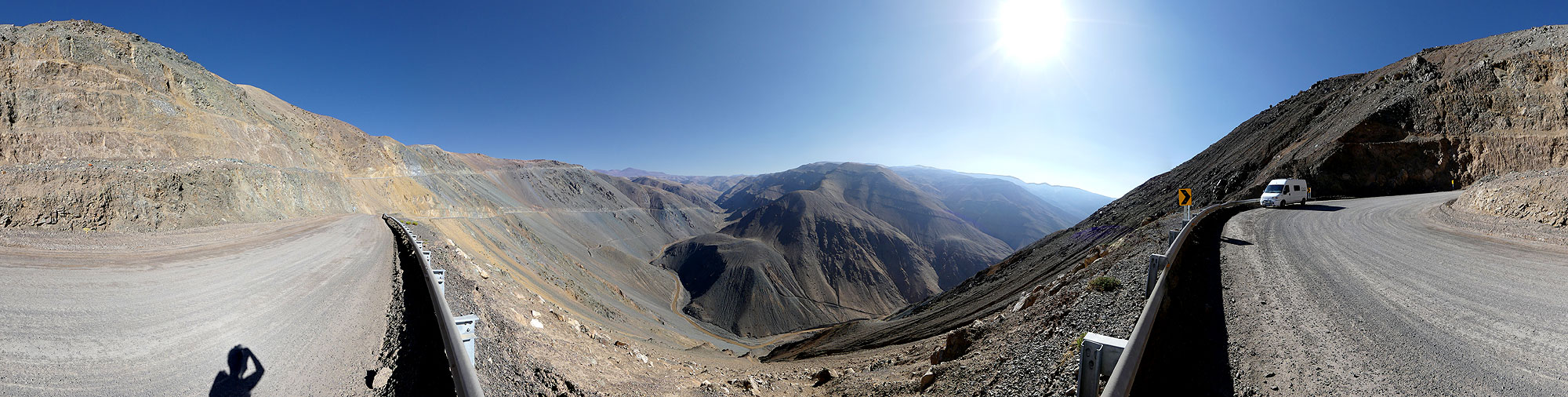 Long switchbacks into a deep canyon - 360° Panorama
(move mouse over panorama and click on the arrows)
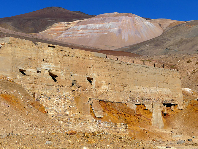
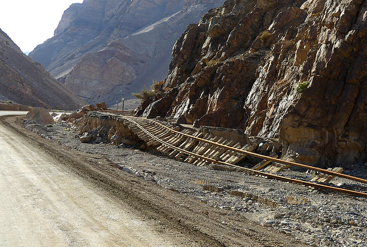
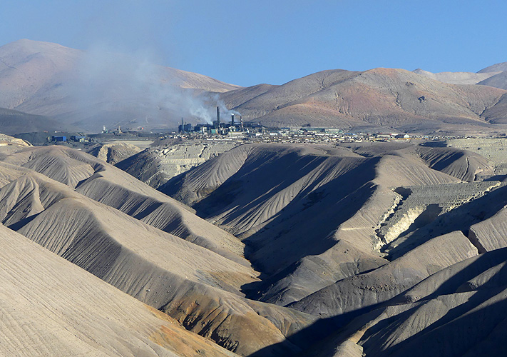
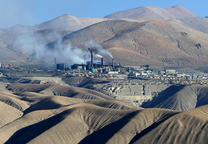
An old railway line followed the road. Most of it was bent and in ruins, evidence that this is mining country. Today everything is transported by trucks. We took a very steep turn off for El Salvador and saw the mining town of Potrerillos where chimneys from a factory were belching out black and grey smoke.
According to our Copec book Potrerillos was declared contaminated in 1997 and all the workers now have to live in El Salvador 38km away and commute to work. The mine was built on a beautiful hillside and we had quite a spectacular view. Unfortunately it is also evidence of how humans destroy the earth!
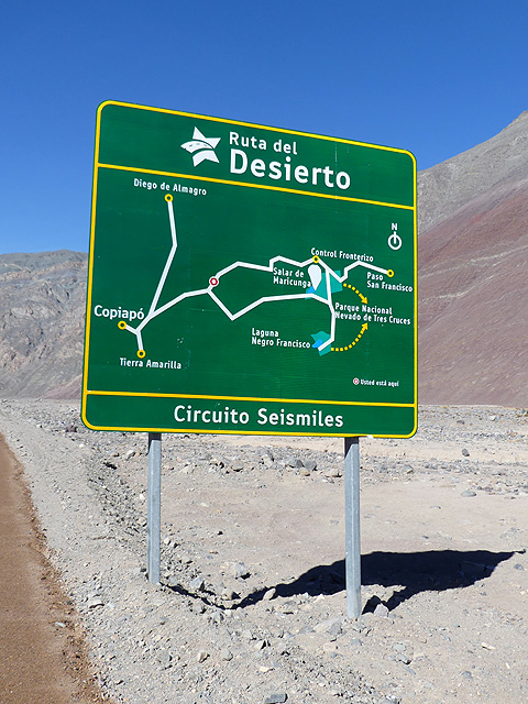
On the way to Paso de San Francisco (4.748m).
The road to El Salvador was more up and downs and we didn't get there until 7-45pm. We'd driven 285km today! We parked up at the main plaza in the small mining town and whilst Kirsten dashed off to the Unimarc supermarket, I did all the dust cleaning. Kirsten came back with a roast chicken still hot from the grill which we had with fresh bread, tomatoes, cucumber and mayo.
It had been a long day but a spectacular one. At least El Salvador is down at 2,250m so we wouldn't have any problems to sleep tonight!