


Click on a photo to enlarge it.
After trying the internet for a couple of hours and not getting very far, Kirsten tried the internet at the library nearby. It was just as slow. We did some last minute shopping and drove along the bumpy roads to the petrol station to fill up. It was 5-30pm by the time we left and we went to the customs office on the outskirts of the town.
We didn't need to exit Chile here because all the paperwork etc. is carried out at the customs office 4km after the pass on the Argentinian side. (Note - for Paso Sico and going into Bolivia you will need to exit at the customs office here in San Pedro.)
We drove onto the good tarmac road that leads up to the Paso de Jama and parked at a spot off the road just a few kilometres out of town. We were up at 2,722 m and didn't want to go any higher for the night. We would try and drive over the pass and down the other side in one day tomorrow.
Not long after we'd parked up Kirsten had a few disasters. First she dropped a lighted match, then she ripped open a bag of rice. I was writing on the computer and had to scramble out of my corner to get a plastic bag and spent a long time picking up all the rice! In the meantime she knocked over a bottle of lemon juice and walked into the corner of the sink which hit her right on the crotch and really hurt!!
Eventually we had curry and rice for our evening meal without the motor home getting burned down or otherwise destroyed!
We set the alarm for the following morning because we would have around 400km to drive up and over the pass. It had taken us a long time to go to sleep but we still managed to haul ourselves out of bed for breakfast and set off at 9am - that's early for us!
The road ascends steadily and we were up at 4,000m fairly soon. It was quite a hot day and we needed the fan on plus the heating on hot to try and keep the engine temperature down. The road goes over several passes en route to the border and there are also several viewpoints. Our GPS showed the highest point as 4830m but according to the maps should have been 4,600m. The actual pass at the border is at 4,275m.
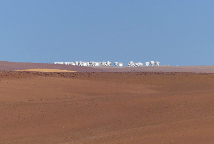
Our guide for the ALMA tour had told us that the telescope antennae can be seen at around KM70 to 75 so we slowed down from KM60 and kept our eyes open. The road is so good that I could do 80km/h without a problem despite the altitude! We found the antennae at KM71 - they were all bunched together and quite easy to see. We needed the binoculars though to get a better view - they were quite a way in the distance on the plateau above us. But we were very happy that we managed to see them.
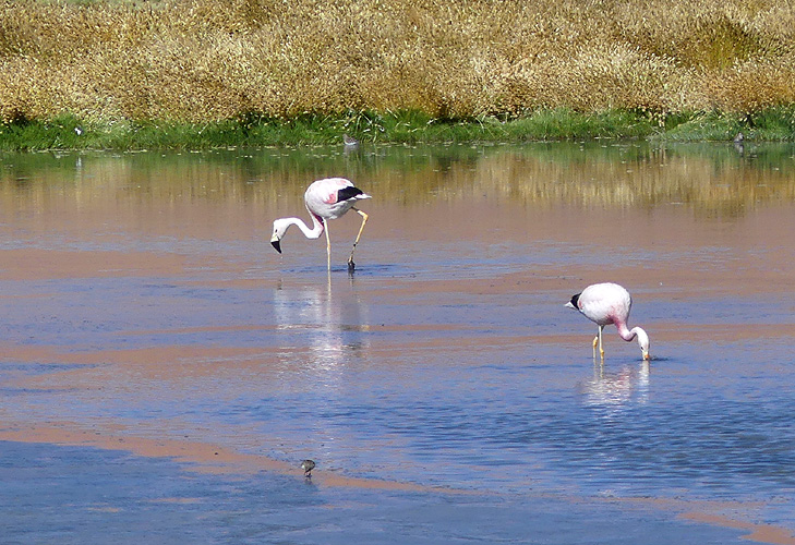
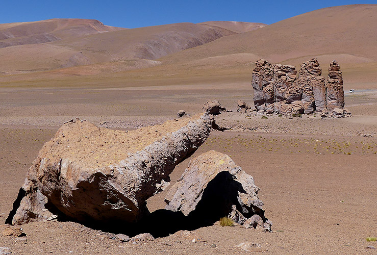
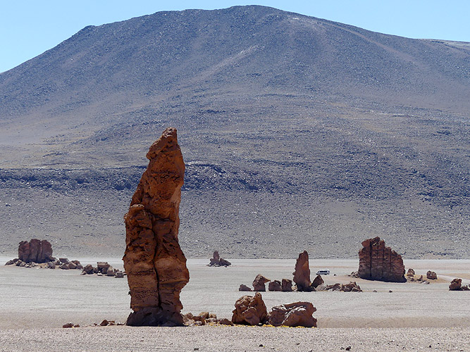
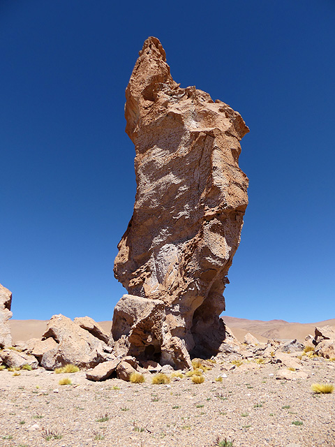
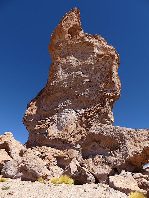
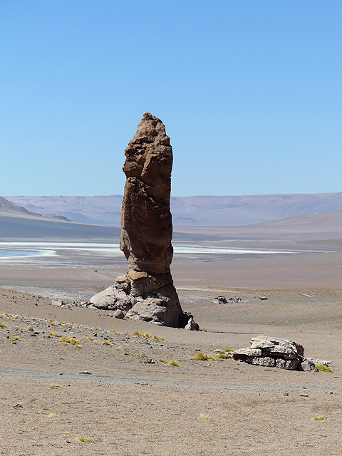
We stopped for an early lunch at a place called the "Rock fingers" - rock formations protruding out of the ground in the desert. We stayed for over an hour for Kirsten to get photos. There were a lot of other transit vans with tour groups there. Further up we passed a laguna but there weren't any flamingoes. We did, however, see a baby vicuña suckling on its mother - well, once it had worked out which end the teats were!
We drove past two more blue lakes and then went downhill to cross the border. We got there at 2pm and the formalities only took 30 minutes in total. The exit and entry were in the same building and there was only a cursory check of our vehicle.
Paso Jama - Part 1
Now in Argentina we drove across a high plateau for nearly two hours, staying above 4,000m. It is a very barren area but we did manage to see a fox. We stopped at a small village called Susques (270km from San Pedro at 3,675m) for a cup of tea and some food. It was 5pm when we left and drove up, over a pass and then through two canyons. The road was bad in places due to dips for water run offs where the road is concrete and has obviously been damaged by the water.
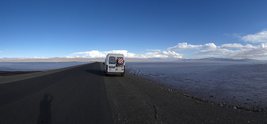
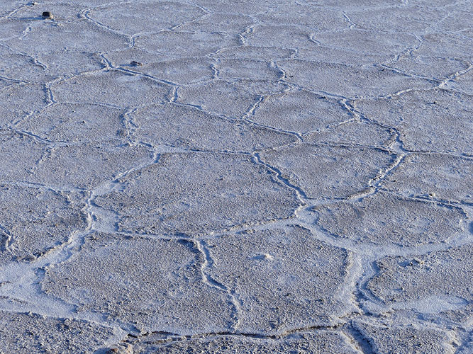
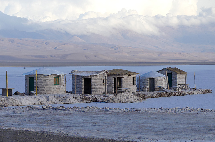
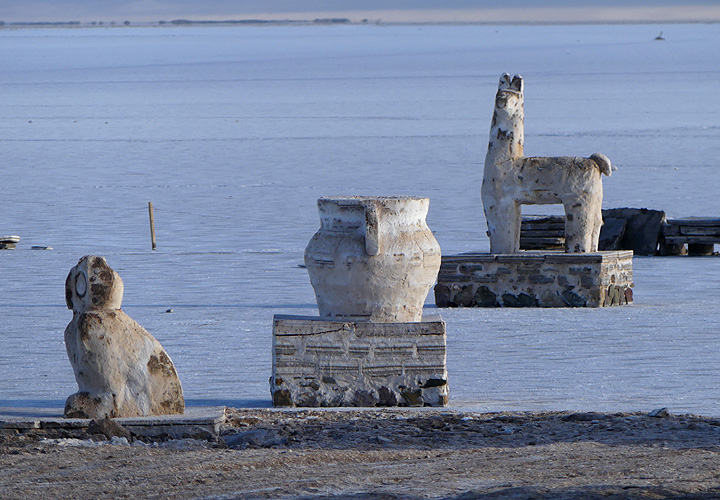
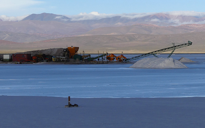
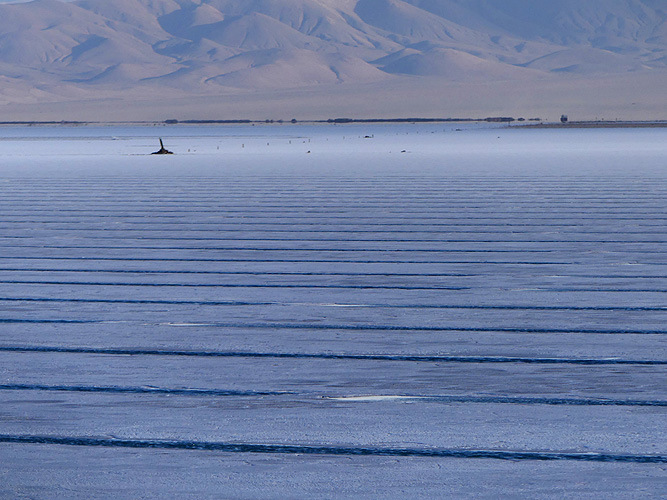
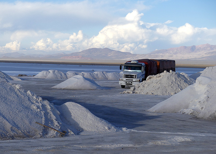
We finally got to Salinas Grandes. It is a huge salt plain that was originally a lake but dried up in the Holocene Era. It is now a 525 sq km crust of salt up to half a metre thick. We spent at least 40 minutes stopping and starting to take various photos. The salt crystals had formed hexagonal shapes and there is a salt mine here. We could see where salt slabs have been cut out and people working on them. They also sell llamas and cacti made from salt.
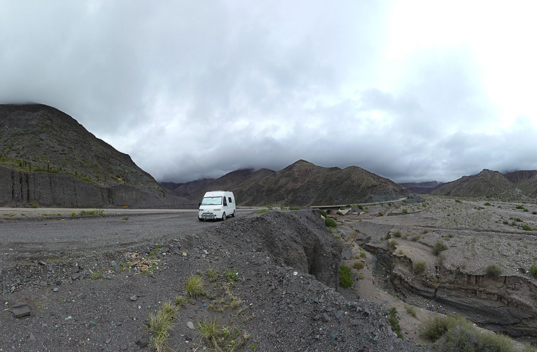
It was 6-45pm when we left and we were running out of daylight but it was only another 65km to Purmamarca, our destination for the night. We didn't make it! The road went up over a pass and then through two canyons. The road was bad in places due to water run off. For these parts the road is concrete and has obviously been damaged by the water. It slowed us down a lot.
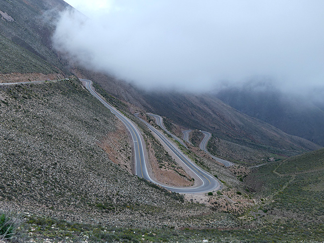
Then we hit the switchbacks down into a valley. I pulled over to let a car pass without realising that it was the perfect place to look down into the valley and see all the switchbacks. We stopped for photos and within minutes the mist came in and we couldn't see a thing! Oh boy, it meant driving down the switchbacks without being able to see very far in front of us. By the time we had dropped down over 1,200m it was fully dark.
Paso Jama - Part 2
Fortunately we knew of two possible spots from iOverlander. The first didn't exist anymore but the second one, 5km further, was good enough for us. We parked up at 8-25 pm. It had taken us over 11 hours and our longest drive of 378km. That evening it rained on and off and the next day it rained all day! It was quite a miserable day so we decided to stay where we were and sit it out.
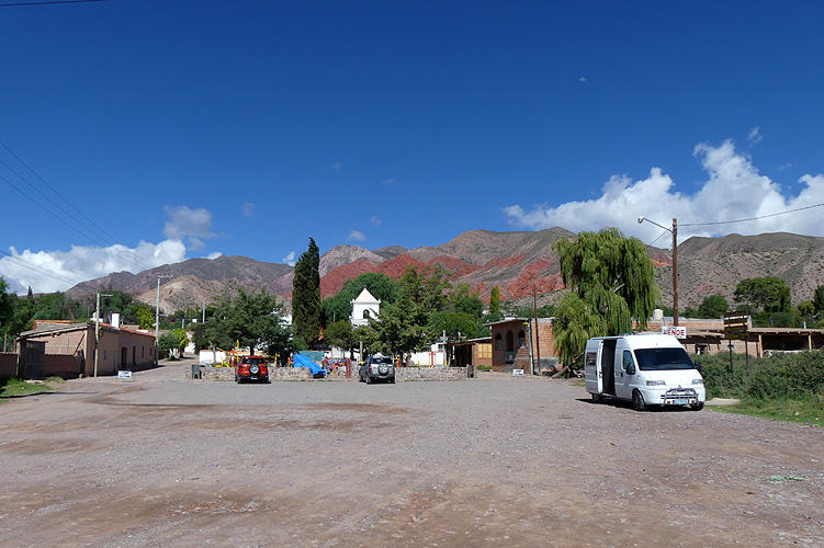
The next day the sun came out so we drove along the rest of the valley into Purmamarca. We had virtually no food left as we'd just come across the border so we needed supplies. I had to go to several shops to get a few things because it is only a small place and no supermarkets.
 Cerro de Siete Colores (Purmamarca) - 360° Panorama
(move mouse over panorama and click on the arrows)
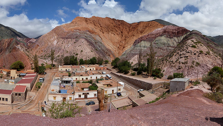
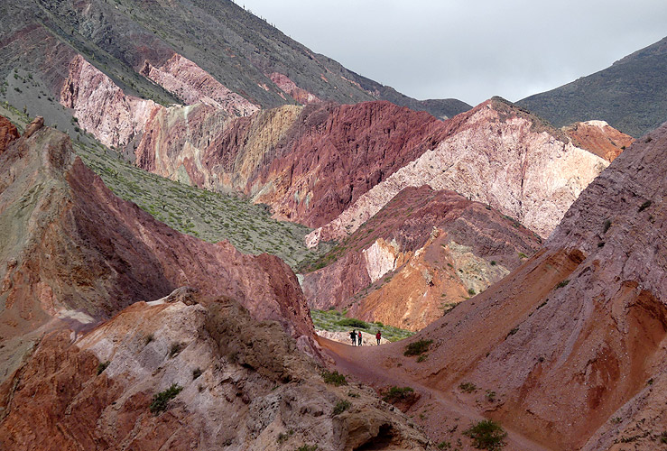
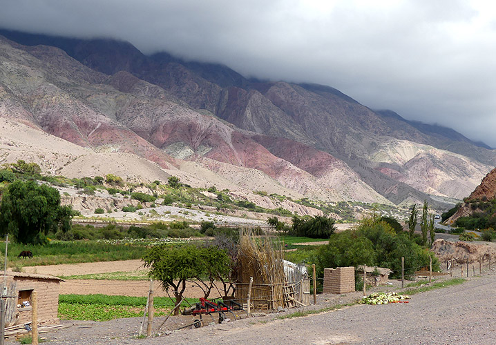
Afterwards we went for a 3km walk to see the Cerro de Siete Colores - hill of seven colours. The colours are created by marine sediments that accumulated in the rock strata over eons. It certainly was colourful and I also walked through a cemetery where some of the graves are built into the hillside.
 Cerro de Siete Colores (Purmamarca) - 360° Panorama
(move mouse over panorama and click on the arrows)
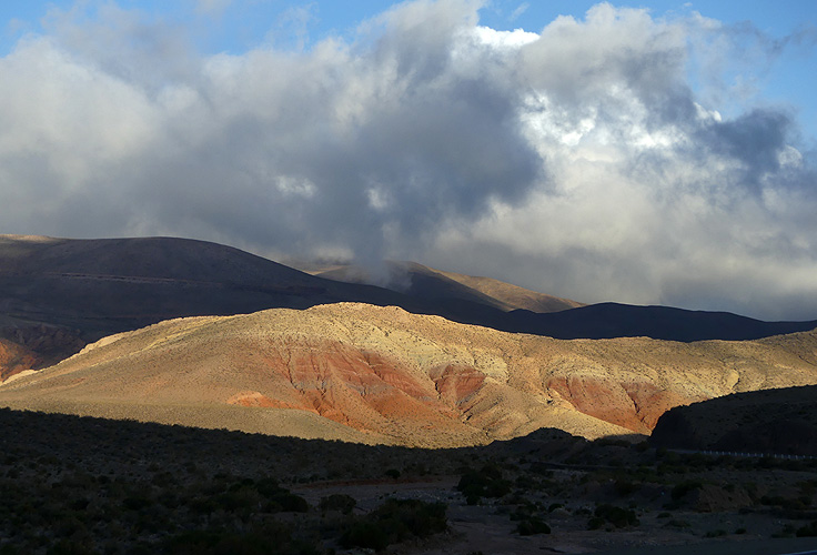
We got to the main road and headed north along the Quebrada de Humahuaca that snakes its way upward towards Bolivia. It's a harsh but vivid landscape - a canyon overlooked by mountainsides whose sedimentary strata have been eroded into scalloped formations that reveal waves of colours. It's a Unesco World Heritage site and a larger scale than the hill in Purmamarca that we had just been to see.
We stopped in Tilcara, a small village where we knew there was another hike into a valley but there was evidence of recent water damage and flooding. There was lots of mud and it looked like flash floods had caused the Rio Grande to swell and burst over its banks. The hike would have been muddy so we continued north and drove away from the looming black clouds and into the sun.
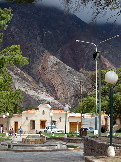
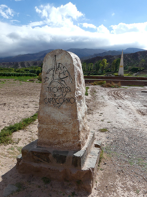
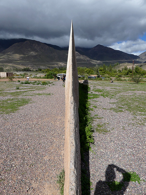
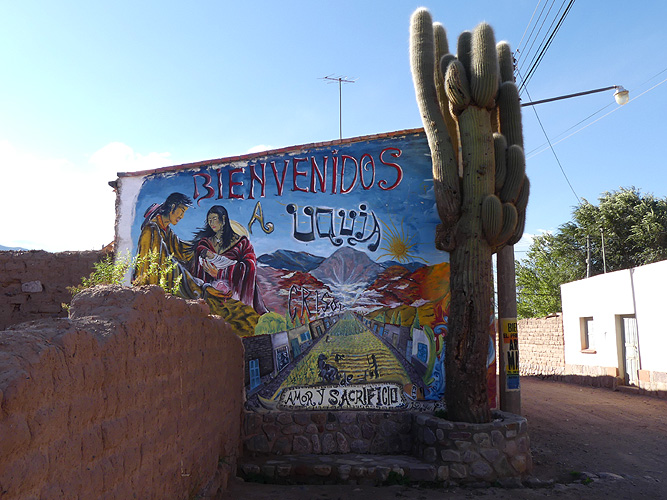
We went to see another hillside cemetery at Maimará with a picturesque backdrop and went past the Tropic of Capricorn. We pulled onto a church car park in Uquía for the night and Kirsten managed to get inside just before the 17th century church was closed for the night. No photos were allowed but it has a gilt altarpiece with fine painted panels.
Purmamarca